








New Google Earth imagery showing the destruction across Gaza has stunned social media users, offering a stark overhead look at how dramatically the territory has changed since the war began nearly three years ago.
The images went viral over the weekend as users compared newer satellite views with imagery from before Hamas’ Oct. 7, 2023, attack on southern Israel and the Israeli military campaign that followed.
Google told Newsweek that its most recent satellite imagery of Gaza dates to June 2026.
“We update satellite imagery from our third-party providers on a regular basis,” it added.
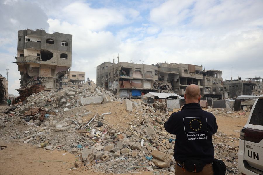
The updated views show heavily damaged neighborhoods, flattened buildings and large sections where rows of homes once stood.
Irish Member of the European Parliament Barry Andrews helped fuel the online reaction after sharing images of Gaza on X.
His post quickly drew millions of views, tens of thousands of likes and thousands of reposts.
Nathan Ruser, an analyst at the Australian Strategic Policy Institute, also weighed in on the new imagery.
“shows the reality of Gaza in shocking resolution.”
The destruction follows the Oct. 7 Hamas attack that killed at least 1,200 people in Israel and resulted in more than 250 hostages being taken.
Israel launched a massive military campaign in Gaza in response, targeting Hamas fighters, weapons sites, tunnels and command infrastructure throughout the densely populated territory.
The war has also left widespread damage to civilian buildings and infrastructure.
The U.N. Satellite Centre said in August that 82% of structures in Gaza, or roughly 200,000 buildings, had suffered some level of damage, with about two-thirds destroyed.
The southern city of Rafah is among the areas drawing the most attention in the updated Google Earth imagery.

 Here’s a closer look at Gaza after Google Maps’ latest update… rubble and little else remains.
I guess nobody in the Israeli government has ever heard: “An eye for an eye makes the whole world blind.”
It’s not even “eye for an eye,” it’s civilization for an eye.… https://t.co/YeU5pkTqhC
— Mario Nawfal (@MarioNawfal) September 28, 2026
Sections that once featured tightly packed residential neighborhoods now appear largely cleared, while makeshift shelters can be seen across wide areas.
Gaza City also looks dramatically different, including neighborhoods surrounding Al Shifa Hospital.
Israel has accused Hamas of operating a command post inside and underneath the hospital complex, allegations denied by Hamas and hospital officials.
Chris Doyle, director of the Council for Arab-British Understanding, said the images offered another record of the scale of destruction.
“The Google images act as yet another record of the systematic destruction of Gaza where at least 82 percent of its buildings have been destroyed or damaged,” Chris Doyle, director of the Council for Arab-British Understanding, told Newsweek on Monday. “These images have shocked the world for years. The question is when they will shift the positions of major leaders, not least the U.S.,” he added.
Rebecca Wolfe, a conflict and humanitarian response expert at the University of Chicago’s Harris School of Public Policy, said the war unfolded in an extremely dense environment where civilian infrastructure and military targets were often located close together.
“Targets were often close to critical infrastructure and civilians,” Wolfe said. “What is hard to digest is that this wasn’t an information problem. Israel very well understood the operating environment and the strength of these weapons. Yet they still used them when targeting individual Hamas militants, even though there were other alternatives to conducting the operation.”
A United Nations report published last week said roughly 1.9 million people in Gaza had been displaced, with many forced to move more than once.
The report also said more than 60% of Gaza’s population had lost their homes.
The updated Google Earth images are now giving millions of people a direct visual comparison of Gaza before and after years of war, turning satellite imagery into the latest flashpoint in the global debate over the conflict.
POLL: Do You Approve Of Secretary Of War Pete Hegseth?
Continue reading...
[ H/T Trending Politics ]