







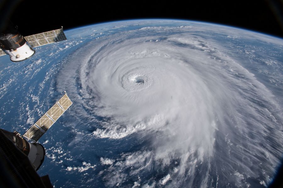
Hurricane Polo rapidly intensified in the eastern Pacific on Tuesday, reaching Category 5 strength as forecasters watched several long-range scenarios that could eventually send moisture or remnants toward parts of the southwestern United States.
The powerful hurricane packed maximum sustained winds of about 160 mph as it churned several hundred miles off Mexico’s Pacific coast.
Polo had been moving generally east before forecasters expected the storm to make a turn toward the northwest and eventually west-northwest.
The National Hurricane Center has not forecast a U.S. landfall, and most projections keep Polo over the Pacific.
Still, some longer-range computer models show possible paths that could eventually bring tropical moisture or remnants toward California, Arizona, New Mexico and possibly western Texas over the next seven to 10 days.
Southern California could be the first U.S. region to notice effects, even if the storm never approaches the coast directly.
Large swells, dangerous rip currents and an influx of tropical moisture could reach parts of the region by the weekend.
Meteorologist Ross Ellet with 13ABC cautioned that most guidance still keeps Polo away from the United States.
‘While a few models have this storm turning into the Gulf of California, and possibly into the Southwestern part of the US, most weather maps push this storm northwest away from land. This will need to be watched in the days ahead.’
Arizona could face a greater chance of tropical moisture if Polo or its remnants eventually move north through the Gulf of California or northern Mexico.
Under those scenarios, heavy rainfall and flash flooding would become the primary threats rather than hurricane-force winds.
Some models also spread tropical moisture eastward into New Mexico during the middle of next week.
Texas remains the most uncertain and distant possibility, with only a small number of projections carrying Polo’s leftover moisture into western or southern parts of the state.
Those scenarios do not show a Category 5 hurricane striking Texas.
Closer to the storm, Mexico faces a much more immediate threat.
A tropical storm watch is in effect along portions of the southwestern Mexican coast, where worsening conditions are possible as Polo tracks nearby.
The storm could dump four to eight inches of rain across coastal Guerrero and Michoacán through Thursday, with isolated totals reaching 12 inches.
Forecasters warned that the downpours could trigger life-threatening flooding and mudslides, particularly in mountainous terrain.
Coastal portions of Oaxaca, Colima and Jalisco could receive three to six inches.
Large swells generated by Polo are also expected to produce dangerous surf and rip currents along Mexico’s southwestern coastline.
Meteorologist Dylan Federico with Florida’s WSVN 7 News said on Facebook: ‘Polo is forecast to become one of the strongest hurricanes of all-time in the Eastern Pacific.’
Hurricane-force winds extend outward only a few dozen miles from Polo’s center, while tropical-storm-force winds spread much farther.
The storm’s rapid strengthening has made it one of the most closely watched systems in the Pacific, but the biggest uncertainty remains what happens after Polo begins its expected turn away from Mexico.
For Americans in the Southwest, the main concern for now is not a direct Category 5 landfall, but whether Polo’s moisture eventually gets pulled north and fuels dangerous surf, heavy rain or flash flooding.
POLL: Should Foreigners Be Banned From Buying American Farmland?
Continue reading...
[ H/T Trending Politics ]