





Tropical Threat Emerges In Gulf Of America With US Refineries In Potential Crosshairs
The National Hurricane Center has raised the probability of tropical development for Invest 91L to 80% over the next two to seven days.
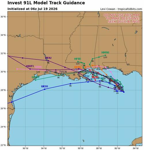
The broad area of low pressure off Florida's west coast in the Gulf of America should be tracked into the new week, as early Sunday model guidance suggests it could eventually threaten offshore oil and gas rigs and coastal refineries.
NHC's latest Invest 91L update:
Formation odds:
Model Track:
Refinery Map:
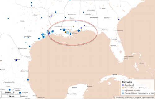
Regardless of Invest 91L's development, the broad area of low pressure will traverse northwest, away from Southwest Florida and towards the New Orleans area.
The Atlantic Hurricane season is beginning to move into an active phase.
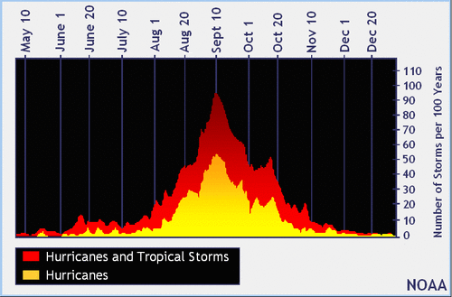
Notably, El Niño generally suppresses Atlantic hurricane activity by increasing upper-level westerly winds and vertical wind shear across the Caribbean and tropics, which disrupt tropical systems before they organize or intensify.
More on developing El Niño here.
Tyler Durden Sun, 07/19/2026 - 13:25
Continue reading...
[ H/T ZeroHedge ]
The National Hurricane Center has raised the probability of tropical development for Invest 91L to 80% over the next two to seven days.
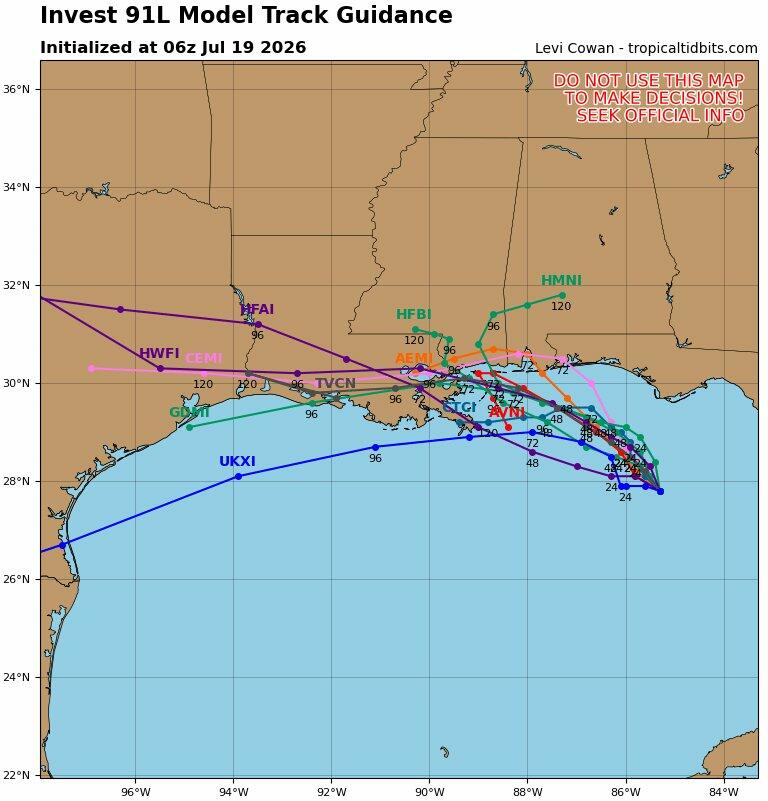
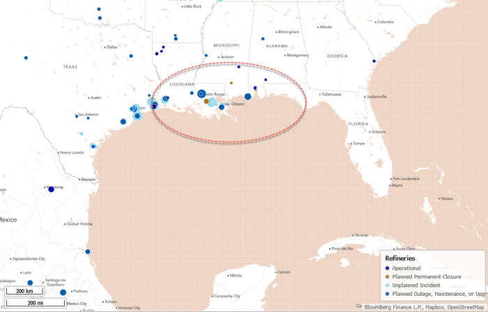
The broad area of low pressure off Florida's west coast in the Gulf of America should be tracked into the new week, as early Sunday model guidance suggests it could eventually threaten offshore oil and gas rigs and coastal refineries.
NHC's latest Invest 91L update:
Formation odds:
- Formation chance through 48 hours...high...80 percent.
- Formation chance through 7 days...high...80 percent.
Model Track:
Refinery Map:
Regardless of Invest 91L's development, the broad area of low pressure will traverse northwest, away from Southwest Florida and towards the New Orleans area.
The Atlantic Hurricane season is beginning to move into an active phase.
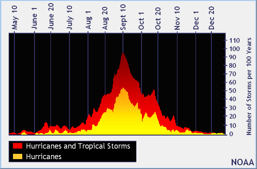
Notably, El Niño generally suppresses Atlantic hurricane activity by increasing upper-level westerly winds and vertical wind shear across the Caribbean and tropics, which disrupt tropical systems before they organize or intensify.
More on developing El Niño here.
Tyler Durden Sun, 07/19/2026 - 13:25
Continue reading...
[ H/T ZeroHedge ]