





Hurricane Isaias made landfall near Destin, Florida, at approximately 8:30 p.m. Central Time on Friday as a Category 2 hurricane with maximum sustained winds of 105 mph and an estimated minimum central pressure of 971 millibars, according to the National Hurricane Center.
The eye came ashore along the barrier islands of the western Florida Panhandle, roughly 40 miles east of Pensacola in Okaloosa County. The system had peaked earlier as a Category 3 hurricane with winds near 120 mph before wind shear contributed to modest weakening prior to landfall.
Within about half an hour of landfall, sustained winds decreased to 85–90 mph, and by the 10 p.m. Central Time advisory the center was located about 45 miles east-northeast of Pensacola and 65 miles northwest of Panama City, moving north at 20 mph with a minimum pressure of 982 millibars. Hurricane-force winds extended outward up to 35 miles from the center, while tropical-storm-force winds reached up to 205 miles.
A wind gust of 116 mph with sustained winds of 91 mph was recorded near Santa Rosa Sound, and other gusts of 97–114 mph were reported at locations including Gulf Breeze and Naval Air Station Whiting Field.
POLL: Should Trump Cut Off Aid To Countries That Side With Iran Over America?
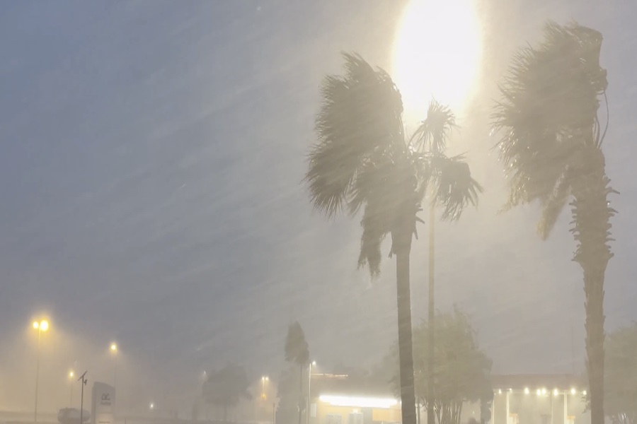
ISAIAS UNLEASHED: Hurricane-force winds are hammering Destin, Florida, where FOX Weather Senior Correspondent Robert Ray is braving the blast as dangerous Category 3 Hurricane Isaias bears down on the Gulf Coast just hours before landfall. pic.twitter.com/OTtDUyEaHY
— FOX Weather (@foxweather) October 9, 2026
Impacts were already widespread at the time of landfall. A National Ocean Service gauge in Panama City Beach recorded a water level of 5.6 feet above mean higher high water, an approximation of inundation in that area, with life-threatening storm surge continuing along the coast from Dauphin Island, Alabama, to the Suwannee River in Florida.
Forecasts indicated the potential for 6 to 9 feet of surge in portions of the western Panhandle. Four to seven inches of rain had already fallen across parts of the region, with rates of 3 to 5 inches per hour prompting a flash flood emergency for Fort Walton Beach, Niceville, and Destin.
Power outages affected hundreds of thousands of customers, as officials indicated confirmed than 250,000 Florida Power & Light customers without electricity, including roughly 70 percent of those in Escambia County, with additional outages in Alabama bringing the regional total into the 400,000–500,000 range. Trees were toppled, coastal highways flooded, and beach communities that had largely evacuated were experiencing dangerous conditions.
“The storm is here. Buckle down at this point. Don’t be getting out on the roads,” Florida Governor Ron DeSantis said during a press conference Friday night. He further emphasized that flash flooding would be a hazard “throughout the region.”
As of late Friday night, Isaias continued moving north across the western Florida Panhandle into southern Alabama. The National Hurricane Center forecast a continued northward motion through Saturday, followed by a turn toward the northeast that would carry the system into the Tennessee Valley by Sunday.
Sustained winds were expected to weaken steadily inland, but damaging gusts were projected to persist well inland through Saturday, particularly in areas of higher terrain. The system was forecast to become post-tropical by Saturday afternoon and to dissipate by Monday.
Rainfall totals of 4 to 8 inches were expected across southern Alabama, the Florida Panhandle and Big Bend, and southwest Georgia, with localized amounts up to 15 inches possible, raising the risk of flash, urban, and river flooding. The tornado threat was projected to continue overnight and into Saturday, mainly east of the center across the Florida Panhandle into southern Georgia and parts of the Southeast.
The Trending Politics News app is your home for breaking updates. Download it FREE today!
Continue reading...
[ H/T Trending Politics ]